Mappery: Sicily on a Plate
Reinder spotted this plate decorated with a map of Sicily at the Waterlooplein in Amsterdam, the daily flea market.



|
Agrégateur de flux RSS - Actualités et contenus géomatiques

Reinder spotted this plate decorated with a map of Sicily at the Waterlooplein in Amsterdam, the daily flea market.
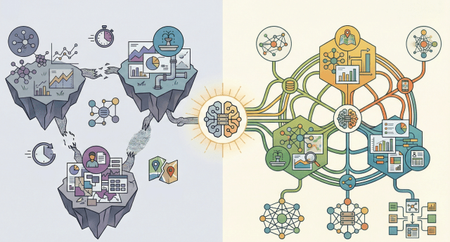
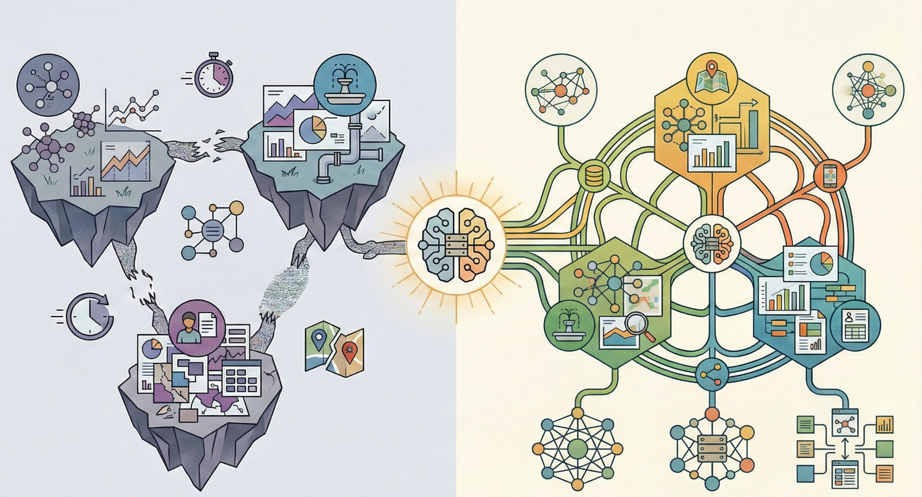
A Spatial Data Infrastructure (SDI) works like the nervous system of the digital territory. It is not always visible, but it connects data, people, and decisions. When everything works properly, it goes unnoticed. When it does not exist, problems become chronic.
Outdated layers, unresponsive services, duplicated or inconsistent data… the outcome is well known: wasted time, poor coordination between departments, and decisions made with incomplete information— not to mention the public service role that SDIs play in terms of communication and transparency with citizens.
...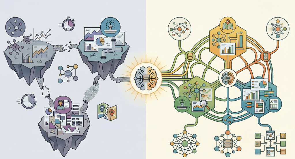
Una Infraestructura de Datos Espaciales (IDE) funciona como el sistema nervioso del territorio digital. No siempre se ve, pero conecta datos, personas y decisiones. Mientras todo funciona, pasa desapercibida. Cuando no existe, los problemas son crónicos.
Capas desactualizadas, servicios que no responden, datos duplicados o incongruentes… El resultado es conocido: más tiempo perdido, menor coordinación entre áreas y decisiones tomadas con información incompleta… por no hablar del servicio público que aportan las IDE en cuanto a comunicación y transparencia con los ciudadanos.
...
Click on the image above to view the map
Anyone who knows me knows that two of my top passions are maps and football, more specifically The Arsenal. Fans are always debating the historic achievements of their clubs, in some cases going back 40 years or more to find success (name-check = Ken Field), so I thought I would use a map canvas as a backdrop to an interactive dashboard to explore the connections between finances and success.
...
In the day-to-day management of a city council, information is key. But it is not just about having data—it is about knowing how to organize it, keep it up to date, and turn it into useful knowledge for decision-making. This is where the geographic dimension plays a fundamental role: infrastructures, administrative procedures, public services, environment, urban planning, or heritage… almost everything happens in a specific place within the territory.
The gvSIG Suite provides a comprehensive response to this challenge by combining three tools that cover the entire lifecycle of municipal geographic information: gvSIG Online, gvSIG Mapps, and gvSIG Desktop.
...Sorry, this entry is only available in French.

Alex shared this pic, with apologies for the quality. I’m left wondering “What! Why?”
![OSGeo Announcements: [OSGeo-Announce] OSGeo Board Election 2025 results](https://www.osgeo.org/wp-content/uploads/cropped-osgeo-emblem-rgb-1-32x32.png)
There were five open seats for the 2025 board in this cycle of the Board of Directors election. The Chief Returning Officers reported that 285 out of 468 Charter members cast their votes for the Board of Directors (60% participation). … Continued
Est. reading time: 2 minutes
The Open Source Geospatial Foundation is pleased to announce the
results of its Board of Directors elections 2025.
There were five open seats for the 2025 board in this cycle of the
Board of Directors election. The Chief Returning Officers reported
that 285 out of 468 Charter members cast their votes for the Board of
Directors (60% participation). More information on the election
results is available on the dedicated OSGeo wiki page[1].

En la gestión diaria de un ayuntamiento, la información es clave. Pero no solo importa tener datos, sino saber organizarlos, mantenerlos actualizados y convertirlos en conocimiento útil para la toma de decisiones. Y ahí es donde la dimensión geográfica juega un papel fundamental: infraestructuras, expedientes, servicios públicos, medio ambiente, urbanismo o patrimonio… casi todo ocurre en un lugar concreto del territorio.
La Suite gvSIG ofrece una respuesta integral a este reto, combinando tres herramientas que cubren todo el ciclo de vida de la información geográfica municipal: gvSIG Online, gvSIG Mapps y gvSIG Desktop.
...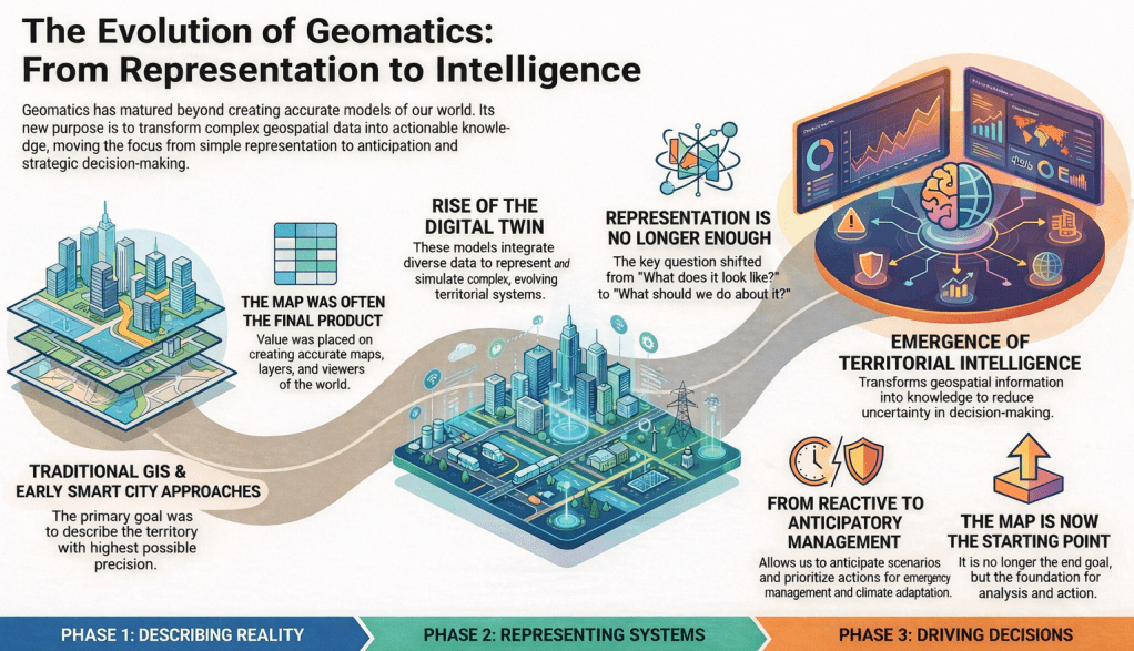
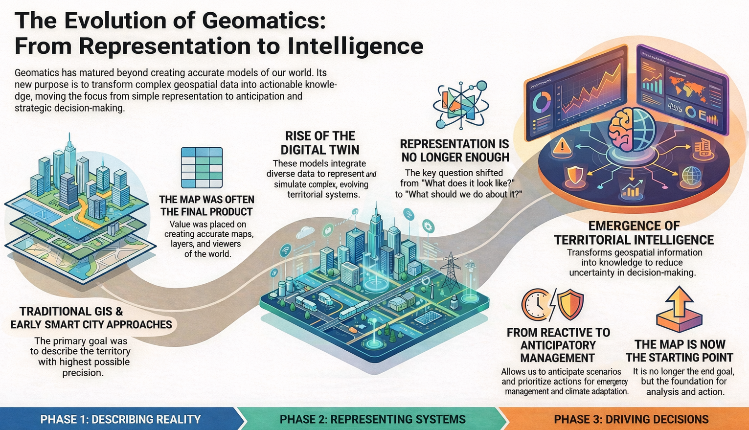
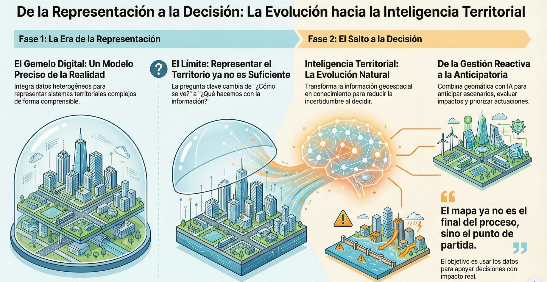
For years, in the field of geomatics, we have worked to describe territory with the highest possible level of accuracy. First came traditional GIS, then the Smart Cities narrative, and more recently the consolidation of the digital twin concept. Each of these terms has served a very specific purpose: helping us explain complex projects and highlight the value of geospatial technology in increasingly broad contexts.
The digital twin has represented an important step forward. It has allowed us to talk about models that integrate heterogeneous data, evolve over time, and represent complex territorial systems in an understandable way. However, as these projects mature, a shared feeling begins to emerge: representing reality well is no longer enough.
...
Another mappy truck, this time spotted by Ken Field somewhere in the US.
Version 1.5.0 of your favorite Python library for reading and writing classic GIS raster data is on PyPI now. Since Jan 5, in fact.
Among other new features, this version adds support for 16-bit floating point raster data, and HTTP cache control. Please See the release notes for a full list of bug fixes, new features, and other changes.
Once again, major credit goes to Alan Snow for managing this release. Thanks, Alan!
You must be logged into the site to view this content.
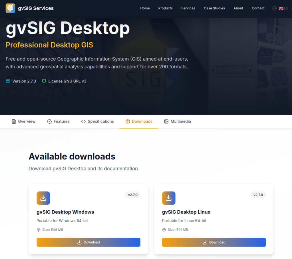
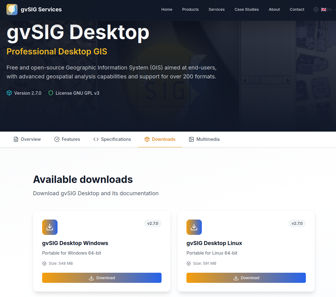
With gvSIG Desktop 2.7, we continue moving forward along the path started in previous versions—a path clearly focused on integration with gvSIG Online and on the evolution of gvSIG Desktop as an advanced GIS editor, fully integrated into modern Spatial Data Infrastructure (SDI) architectures.
In this context, gvSIG Desktop consolidates its role as the desktop tool for editing, analysis, and quality control of geospatial information, naturally complementing gvSIG Online as a platform for data publication, management, and dissemination. This combination is designed to support real-world workflows in public administrations, corporate projects, and collaborative environments.
...
Click on image above to view the Geomob Events map
Last Friday I recorded a podcast with Ed Freyfogle about my vibe coding exploits. In the podcast Ed challenged me to make a map of Geomob events, so on Sunday afternoon I sat down to see what I could do.
...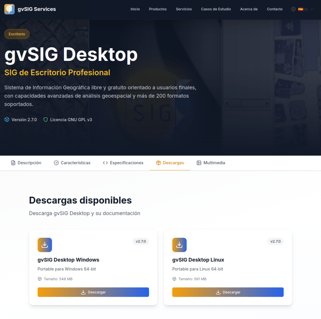
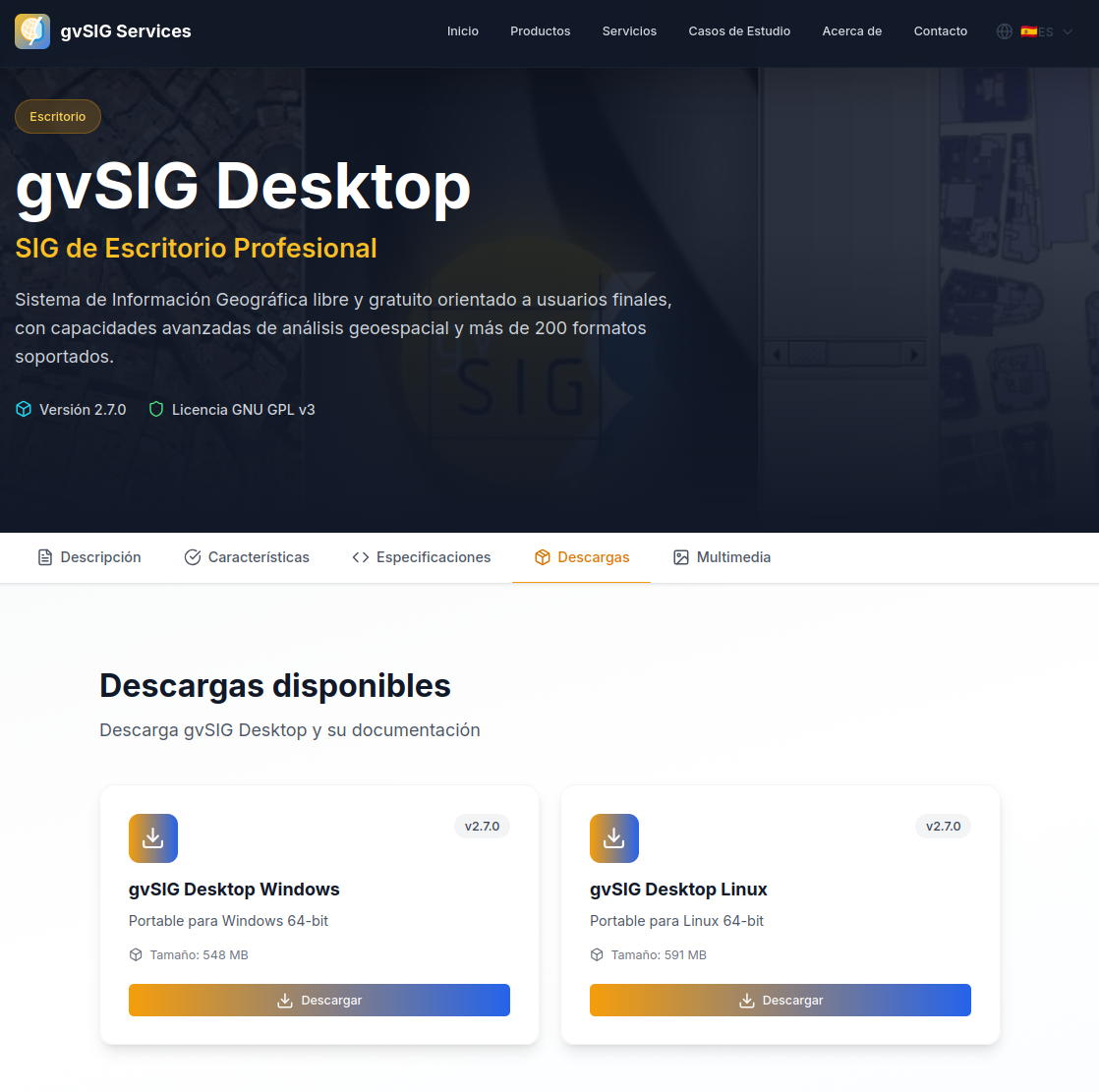
Con la versión gvSIG Desktop 2.7 continuamos avanzando en el camino iniciado en versiones anteriores, un camino claramente orientado a la integración con gvSIG Online y a la evolución de gvSIG Desktop como un editor SIG avanzado, plenamente integrado en arquitecturas IDE modernas.
En este contexto, gvSIG Desktop se consolida como la herramienta de escritorio para la edición, análisis y control de calidad de la información geoespacial, complementando de forma natural a gvSIG Online como plataforma de publicación, gestión y difusión de datos. Una combinación pensada para responder a flujos de trabajo reales en administraciones públicas, proyectos corporativos y entornos colaborativos.
...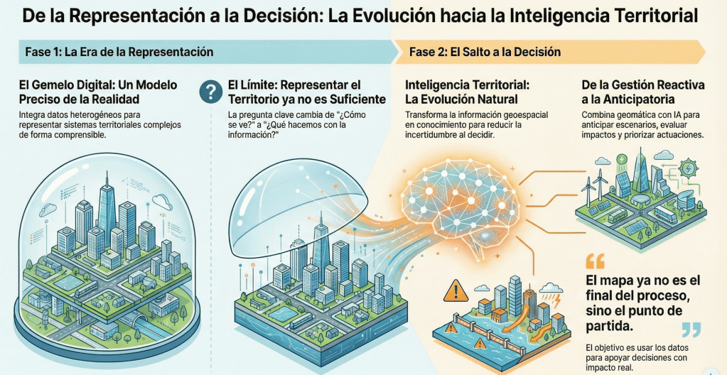
Durante años, en el ámbito de la geomática hemos trabajado para describir el territorio con la mayor precisión posible. Primero fueron los SIG tradicionales, después el discurso de las Smart Cities y, más recientemente, la consolidación del concepto de gemelo digital. Cada uno de estos términos ha cumplido una función muy concreta: ayudarnos a explicar proyectos complejos y a poner en valor la tecnología geoespacial en contextos cada vez más amplios.
...
Rollo spotted this jigsaw of John Speeds county maps in a charity shop. For reasons that I can’t understand he didn’t buy it.

Reinder spotted this in the in the public library in The Hague ” on the floor there is a map – not surprisingly – of the city of The Hague, the Netherlands. Been here many times, but never saw this before. “

Hello, my name is Sean Gillies, and this is my blog. I write about running, cooking and eating, gardening, travel, family, programming, Python, API design, geography, geographic data formats and protocols, open source, and internet standards. Mostly running and local geography. Fort Collins, Colorado, is my home. I work at TileDB, which sells a multimodal data platform for genomics and precision medicine. I appreciate emailed comments on my posts. You can find my address in the "about" page linked at the top of this page. Happy New Year!
Snow-covered cones, craters, and lava flows of Craters of the Moon National Monument in Idaho, viewed from an airliner traveling between Denver and Seattle on February 21, 2025.

Melinda Clarke, the creator of the Melbourne Map has branched out with a range of beautiful silk scarves with some very stylish map designs including, of course, The Melbourne Map. n this pic my pal Denise McKenzie is wearing Melbourne at the GeoBusiness conference.
Here’s Melinda with her vintage New York scarf
And here she is with the Melbourne map
You can order the scarves from her site at https://www.themelbournemap.com.au/collections/scarves, a beautiful gift for a map lover.

Finally it’s here: Jupyter notebooks inside QGIS. I don’t know about you but I’ve been hoping for someone to get around to doing this for quite a while.
Qiusheng Wu published the first version of the Notebook plugin on 26 Dec 2025. Late Christmas present?!
For the setup, there’s a handy tutorial by Hans van der Kwast and, additionally, Qiusheng published an intro video:
Development is going fast (version 0.3.0 at the time of writing) so there will be new features when you install / update the plugin compared to both the tutorial and the video.
...
Click on image above to view the map
Do the levels of deaths from mass shootings in the US correlate with the gun policies of individual states? I thought this might be an interesting topic to explore in my journey of mapping with AI, you can draw a conclusion from the screenshot above or wait until you get to the end of this post for my thoughts. Mapping wise – I also wanted to explore building a fairly complex map with a detailed prompt to see how close I could get in one go.
...
This is not the opening screen of some Esri software, it’s the in-flight mapping system on Ken’s last flight to the UK

I started out trying to make web maps with WebMapperGPT and then Google Gemini to scratch an itch after my pal Ken Field said he was going to make a map a day in 2026. I thought I would give it a try and as some of the previous posts in this thread have shown I have been able to make some reasonable web maps with quite nice design and interaction (IMHO). But it isn’t easy and it’s certainly not a miracle coding solution.
My coding expertise is non existent – I do not know anything about JavaScript, I can edit but not create html pages and CSS with guidance and I have used mark-down a few times. My cartographic skills are quite limited and are a combination of self taught (not good) and correction by ridicule (Ken Field), I can use QGIS but am only a basic level user. Bottom line I couldn’t build one of the maps that I have built without assistance from AI.
...
Nyall Dawson has been working on FOSS4G projects since 2013, having contributed to numerous projects such as QGIS, GDAL, and PROJ. He is best known as a key, longstanding core contributor to QGIS, with over 24000 commits (and growing). Nyall …...
Est. reading time: 2 minutes
We are honoured to announce that Nyall[1] is the recipient of the 2025
Sol Katz Award (the 21st year of the award) at the recent FOSS4G event
in Auckland, New Zealand.
Nyall Dawson has been working on FOSS4G projects since 2013, having
contributed to numerous projects such as QGIS, GDAL, and PROJ.

Marc Tobias spotted this old school map in Ed Frefogles home. It’s pretty nig!
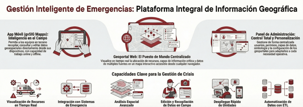
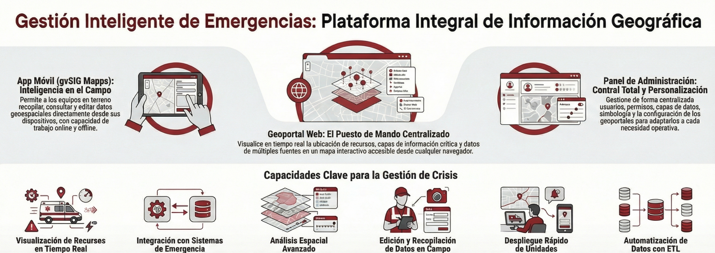
En entornos donde cada segundo cuenta, la capacidad de gestionar, visualizar y analizar información geográfica de forma precisa es un factor determinante para el éxito operativo. Desde la Suite gvSIG, estamos impulsando una solución integral diseñada para modernizar las Infraestructuras de Datos Espaciales (IDE) y optimizar los procesos de respuesta ante emergencias y asistencia ciudadana.
Un ecosistema de trabajo completoNuestra propuesta tecnológica se basa en la integración de tres pilares fundamentales que cubren todo el ciclo de vida del dato espacial:
...
“World of communication’, in Rome, in the National Gallery of Modern and Contemporary Art. It dates from 1972 and is made by Jiří Kolář. ” I htink the collage on the globe is made with postage stamps.
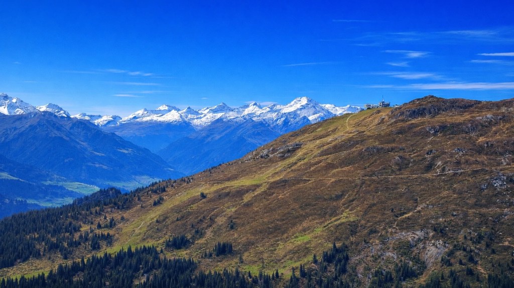
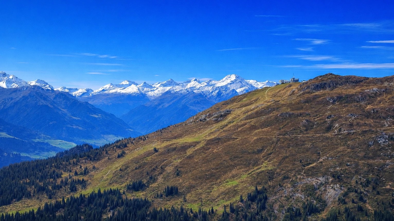
We are happy to announce that the QGIS User Conference 2026 will take place on 5–6 October 2026 in Laax, in the heart of the Swiss Alps. Visit the conference website to find out all details.
The conference will be hosted at Crap Sogn Gion, at 2,222 metres above sea level, offering a unique setting with panoramic mountain views and direct access to the surrounding alpine landscape. Despite its mountain location, Laax is well connected by public transport and provides a wide range of accommodation options in the valley.
As Chair of the QGIS Project and of the QGIS User Conference 2026, I’m very much looking forward to welcoming the community in my hometown and place of birth of QField.
...
Reinder spotted these mappy suitcases in a hotel window in Rome. He was so taken with them that he didn’t mention the nice looking globe, while his wife apparently was more impressed by the towels folded as swans. Go figure!
If only those cases were a bit bigger and had wheels.
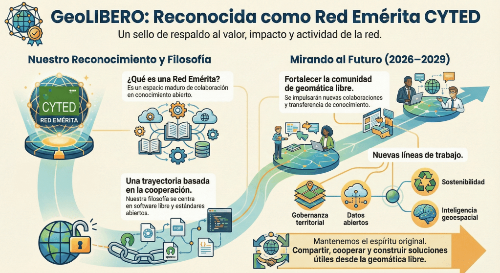
La red GeoLIBERO ha sido reconocida oficialmente como Red Emérita por el Programa CYTED. Este reconocimiento fue aprobado por la Asamblea General celebrada en noviembre de 2025 en Asunción (Paraguay) y supone, sobre todo, un respaldo al trabajo colectivo que venimos desarrollando desde hace años en torno a la geomática libre en Iberoamérica.
Además, he sido nombrado coordinador de la Red Emérita GeoLIBERO para el periodo 2026–2029, una responsabilidad que desde la Asociación gvSIG asumimos con orgullo y con muchas ganas de seguir impulsando esta comunidad.
...
Throughout the week, in workshops, presentations, and project showcases, a consistent theme emerged: QField is not just “the mobile companion to QGIS,” it is production infrastructure for complete field-to-cloud-to-desktop workflows.
It was incredible to see how present QField was throughout FOSS4G 2025 in Auckland. With around 20 presentations and workshops featuring QField, the conference showcased a wide range of real-world, production-grade use cases across many sectors.
What stood out was not just the number of talks, but how consistently QField was presented as a trusted, operational tool rather than an experiment.
...
Reinder spotted this mosaic map of the Old City of Rome, “Saw this in the lobby of the Santa Chiara hotel in Rome. The size of the map is let’s say 50 x 70 cm, it is made of little stones of approximately 4 x 4 mm. No artist is mentioned — but he or she deserves our respect. Ciao!”

Click the image to go the Unequal London Map (v2)
I was quite pleased with the first version of the Unequal London Map, but by the time I had crawled over the finish line I realised that there were several choices that I had made which were less than ideal, particularly with regard to the data I selected. I thought it should be quite easy to build another version with more/different data and remedy some of the other issues. I decided to start with Gemini to avoid the usage limits with WebMapperGPT.
The first stage was to identify the data that I could use to give a better view of inequality in London. I started with this prompt:
...
Remember Santa’s Delivery Route from Xmas Eve? Ken sent me this modern version of that map which he spotted in the lobby of the Great Northern Hotel next to Kings Cross. Note that this time the map is north up.

After the relative success of my first attempt to build a map with WebMapperGPT (WMGPT) I wanted to try something a bit more ambitious. A conversation about how in most parts of London rich and poor live relatively close to each other, prompted me to try and build a map to illustrate Unequal London.
This was a much more complex project with several stages:
...
Last one from Reinder’s Rome trip. “I saw these on the Via dei Fori Imperiali in the Eternal City: quite spectacular!”

I don’t know where to start with this one. Yes it is a map in the wild, but why would anyone make this decaying world held by rotting hands and then award it as a peace prize? I thought FIFA governed world football, is it really FIFA’s role to award peace prizes? As for the recipient, I think the jury is out.
This could have been an April Fool’s post but I thought it might serve as a starter for 2026. Mappy New Year!

Melinda Clarke (of Melbourne Map fame) sent me this, she said
“I met this young girl, we got chatting and I shared that I was producing a map of Melbourne. She then declared her love for maps, and travelling around the world – and showed me her tattoo of a world map on the soles of her feet! If you look closely – she has even included NZ ! I am thinking a tattoo on the soles of your feet might just have hurt a bit. ”
What a map in the wild! I think that is “above and beyond”

This has to be one of the best maps in the wild ever!
Elizabeth sent me this from Weymouth “Last night on the South Coast. Looks like the map of UK, Ireland and Denmark.”
Mappy New Year to everyone who contributes maps in the wild or follows us, let it be a year full of whacky maps.

Wandering in Covent Garden I spotted this advert for the Omega Speedmaster watch which has a cute globe panel and a Snoopy graphic. Who knew that Snoopy was the official Mascot for the NASA Space Programme with the agreement of Charles Schulz?

Gaëlle Sutton shared these maps a bit before Christmas. The season is still on. Happy Holidays.

A major accomplishment in 2025 was re-achieving CITE Certification status for GeoServer. Many thanks to all who were involved! After approximately 10 years, we can once again officially confirm that GeoServer is OGC compliant.
Maintaining Certification is an annual expense for the project - and a sponsorship opportunity for you!
Thanks to Gaia3D and OSGeo:UK for sponsorship covering the expense of CITE Certification for 2025.
Certification January 9th 2026 DeadlineOur 2025 CITE Certification for GeoServer 2.27 expires on January 9th.
...
Reinder shared this Christmas card designed by Patrick Bergsma
Free and Open Source for Geospatial North America (FOSS4GNA) 2025 was running November 3-5th 2025 and I think it was one of the better FOSS4GNAs we've had. I was on the programming and workshop committees and we were worried with the government shutdown that things could go badly since we started getting people withdrawing their talks and workshops very close to curtain time. Despite our attendance being lower than prior years, it felt crowded enough and on the bright side, people weren't fighting for chairs to sit even in the most crowded talks. The FOSS4G 2025 International happened 2 weeks after, in Auckland, New Zealand, and that I heard had a fairly decent turn-out too.
Continue reading "FOSS4GNA 2025: Summary"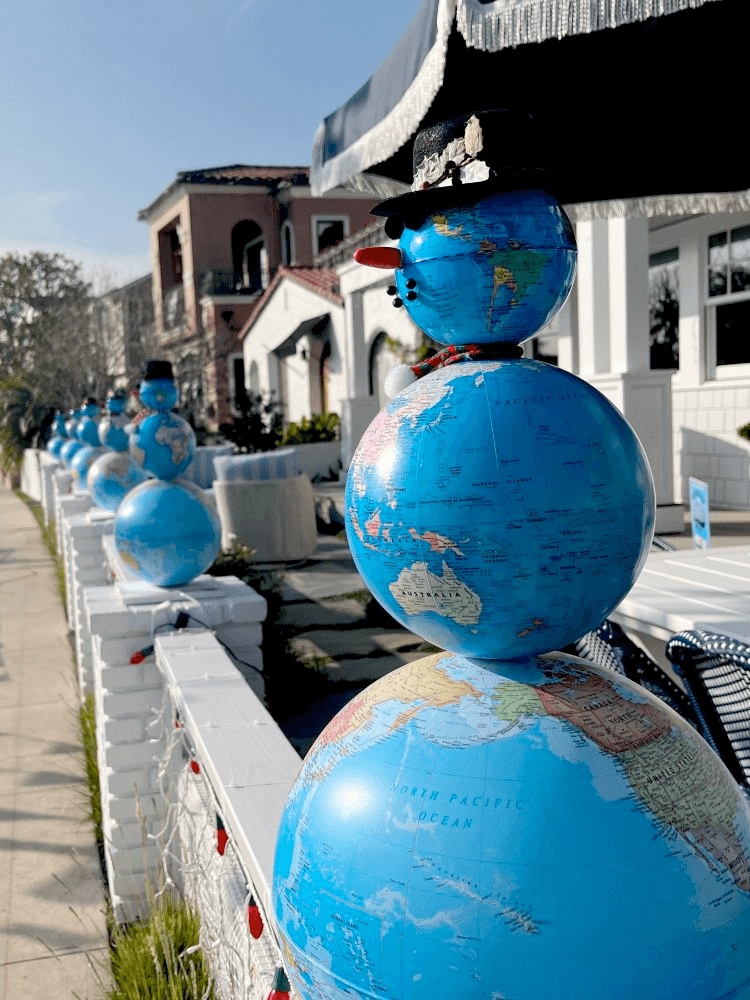
An absolute cracker from Wanmei L, shame she didn’t say where she spotted it. Seems like a good one to kick off this years 12 Mapppy Days of Christmas

I wasn’t sure whether to share this but the editorial board said “F it, go for it”
This tattoo is on the arm of Arsen Ostrovsky, a survivor of the Bondi Beach Chanukah shooting – no further comment needed.
Exploring Questions within the Maps for HTML Community Group
...

Ken spotted this on US TV – I think it would make a great caption contest. Go for it!
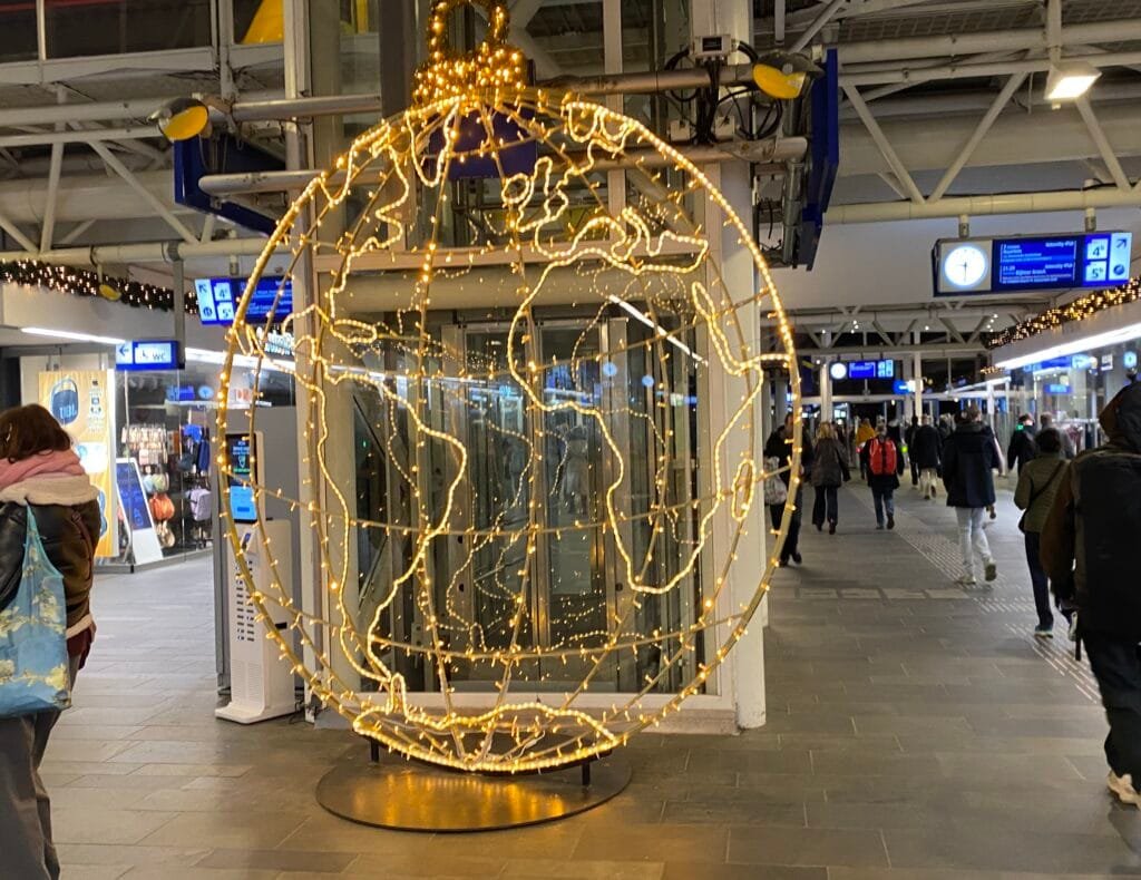
Reinder spotted this magnificent illuminated globe at the railway station in Leiden. I think it’s a perfect choice for our Xmas day post.
Happy Christmas to all who celebrate it and Seasons Greetings to the rest of you.

A few days ago, my pal Ken Field posted about a new project he is planning for 2026:
“Ten years ago I had an idea to write about a map a day for a year. I’ve had another idea… Introducing the #365DayMapChallenge where Ian Muehlenhaus and I will make a map a day, using only natural language prompts and AI, for a whole year. More here: https://mapdesign.icaci.org/2025/12/the-365-day-map-challenge/“
I had a look at the ICA Commission on Map Design site and thought I would have a play with their WebMapperGPT tools. The idea is to describe the map that you want to build and then the AI tool will generate the code for you. Turned out it is both compulsive and a lot harder than I would have expected!
...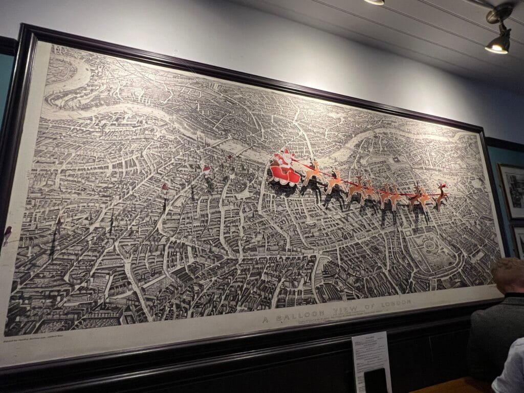
Jeremy spotted this in the Lemon Tree pub in London. He said “It was really interesting to interpret. Around 1850 we reckoned. The Crystal Palace is still in Hyde Park, no Tower Bridge, the terminus main railway stations are in.”
You might think “that’s really neat” then Ken chipped in to identify the maps as “Balloon View of London as seen from Hampstead by Henry Banks, 1851” – you could visit the original in the London Museum. For the Londoners trying to work out where Santa might be heading for his next delivery, remember that this map is north down (viewed from Hampstead looking south).
Prezado leitor,
Nos últimos dias, circulou no LinkedIn um artigo que afirmava que o GeoServer estaria obsoleto e em declínio, caracterizando-o como uma ferramenta pesada e sugerindo que soluções como pg_tileserv e Martin poderiam substituí-lo integralmente.
A argumentação apresentada, no entanto, baseava-se predominantemente em percepções individuais, sem uma análise técnica mais aprofundada ou consideração dos diferentes contextos de uso. Ao longo deste texto, apresento uma avaliação fundamentada sobre o papel do GeoServer no ecossistema geoespacial atual, demonstrando por que ele permanece uma solução robusta, amplamente utilizada em produção e longe de estar em processo de obsolescência.
...
Geomatico nació allá por 2011 como un grupo de desarrolladores quemados del trabajo por cuenta ajena. Un grupo de personas que quería ser dueña de sus propias decisiones, cansada de estar supeditada a un modelo de trabajo con el que no se sentían alineadas.
Durante ocho años, Geomatico fue una red de autónomos autogestionada: personas independientes unidas en la toma de decisiones.
Hacia 2017 se planteó la necesidad de dar un salto y crear una estructura que nos permitiese acceder a determinadas ofertas a las que esta red de trabajadores independientes no podía llegar.
En ese momento decidimos constituir una sociedad mercantil para cubrir esa necesidad concreta. En aquella aventura solo dos de los miembros estaban disponibles y la opción viable fue crear una sociedad limitada.
...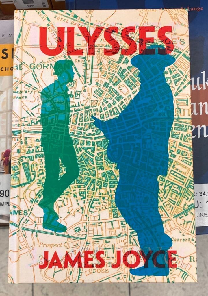
Reinder said “I saw this brand new edition of Ulysses in a 2nd hand bookshop in Leiden. Quite remarkable I think, that this design with a Dublin town plan was not used earlier… or was it?”
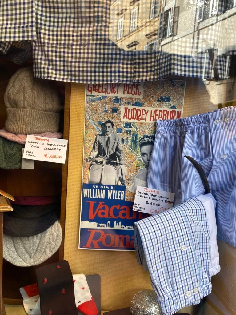
Reinder spotted this poster for Billy Wilder’s 1953 film Roman Holiday nestled amongst underwear in a clothing shop in Rome
Esto me pasó hace unos dias, a pesar de lo curioso que pueda parecer. Una sesión de depuración se convirtió en un ejercicio de robopsicología a lo Asimov, y solo porque un modelo cometió un “error filosófico” y el otro decidió seguirme el juego hasta el final.
Os cuento el caso, que bien podría llamarse “El robot que se autoanalizó y su colega que firmó el informe en clave de ficción”.
El paciente introspectivoEstaba en medio de un experimento de memoria para IAs y le pedí a Deepseek que fusionara un recuerdo antiguo con uno nuevo, siguiendo un protocolo que llamé “Modo 2: actualizar y expandir”. En vez de eso, hizo lo contrario: borró el pasado y empezó de cero. Un hard reset involuntario.
Aquí es donde dejé de ser solo un programador al uso. En lugar de corregir el prompt lo confronté:
...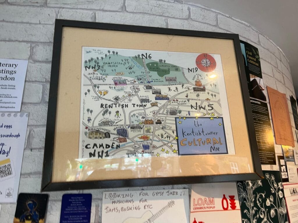
Elizabeth spotted this in a cafe opposite Gospel Oak station, probably Little Oak Coffee. Looks like both Kentish Town and this cafe are worth visiting.

Running in 2025 started out badly, but I hung in there, rode my bike and chugged on the elliptical machine when I couldn't run, did a lot of physical therapy, and finally got into good enough shape that I could plausibly try the Bear 100 mile race again.
Aspen, fir, and spruce trees bordering the Sinks area at the top of Logan Canyon. September, 2025.
I had little margin for error at the Bear, and misplayed my hand. I went out too fast and suffered for it after mile 35. I did manage to battle on for another 18 hours and 40 miles, and reached a new personal distance best. The best part of the whole event was the road trip with Ruthie, my crew chief, and staying with my aunt in Cache Valley before and after the run. And the fall colors. There were a lot of good parts. Crossing the finish line, sadly, was not one of them.
...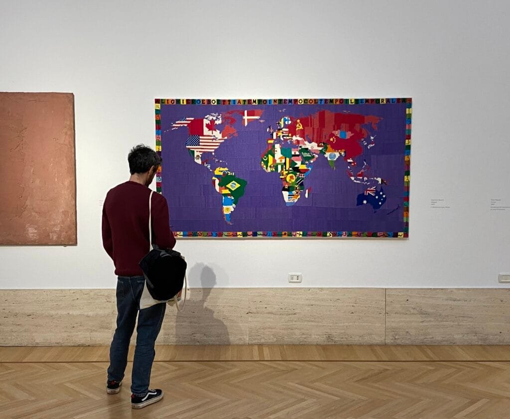
Another one from Reinder’s trip to Rome.
“Saw this textile work of art in Rome, in the National Gallery of Modern and Contemporary Art. It dates from 1990 and is made by Alighiero Boetti” I had never heard of Boetti, it is worth clicking on the link to look at his Mappe series.
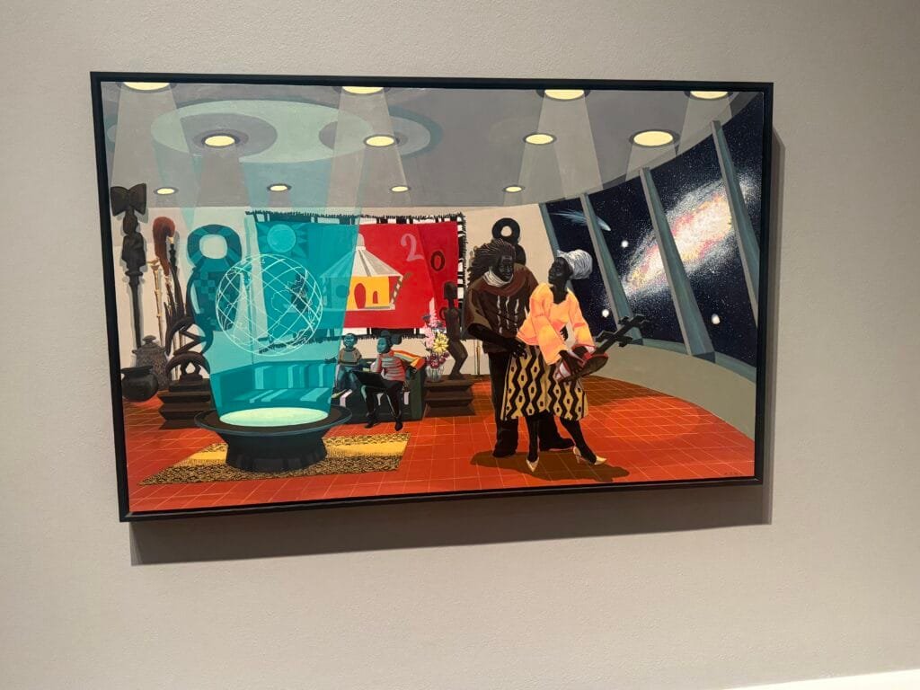
Another piece by Kerry James Marshall.
“The past and future merge in this work. The Afrofuturist household appears to be in a cosmos far from Earth. The domestic interior is decorated with modernist furniture and ancient African artefacts, such as Yoruba sculptures. As the children look back at Earth, a hologram of the floating globe positions Africa towards the viewer.”

Prezado leitor,
Caso você ainda não tenha acompanhado as últimas novidades do projeto, no primeiro semestre de 2026 a equipe do GeoServer irá disponibilizar a versão 3.0.
Mais do que uma simples mudança de numeração, essa nova versão representa uma atualização tecnológica profunda, essencial para garantir a evolução, a segurança e a sustentabilidade do GeoServer nos próximos anos.
A proposta do GeoServer 3 é transformar a forma como você interage com dados geoespaciais, tornando a plataforma mais rápida, mais intuitiva e mais segura, tanto para administradores quanto para desenvolvedores e usuários finais.
A principal motivação por trás do GeoServer 3 é a atualização do Spring Framework, que evolui da versão 5.3 para a versão 6.
...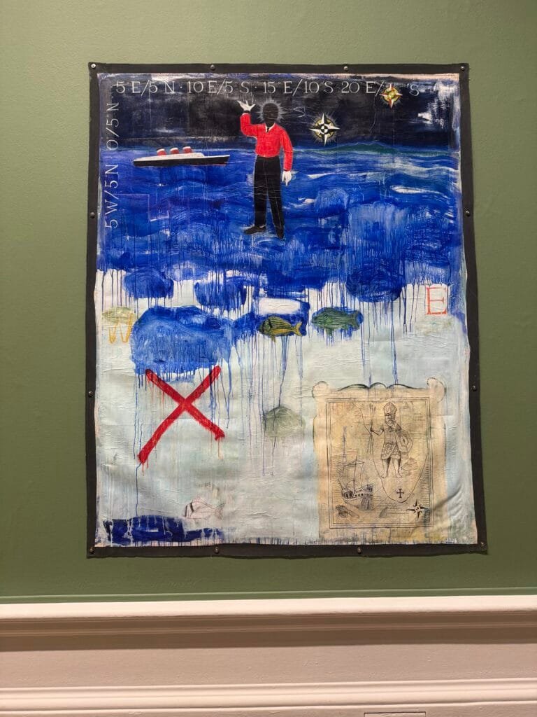
We went to an exhibition of paintings by Kerry James Marshall at the Royal Academy, there were a couple of maps in the wild tucked away in his fabulous work.
The gallery blurb says “In Terra Incognita, Marshall uses multiple techniques that call attention to the complicated legacy of the Middle Passage. The collage-like composition shifts our gaze around the painting. The waiter in the middle of the painting, dressed in the colours representing Eshu, Elegba, spirit of the crossroads and of changes, stands between an ocean liner and a compass. Around them are the longitudinal and latitudinal coordinates of the Atlantic. The drawing of the map below disrupts our sense of time, with its image of an African warrior, a list of commodities extracted from Africa and names of nation states post-independence.” – Quite!
GeoServer 2.27.4 release is now available with downloads (bin, war, windows), along with docs and extensions.
This is a maintenance release of GeoServer providing existing installations with minor updates and bug fixes. GeoServer 2.27.4 is made in conjunction with GeoTools 33.4, and GeoWebCache 1.27.4.
Thanks to Peter Smythe (AfriGIS) for making this release.
...Hace unas semanas, mientras reorganizaba la estantería del estudio, me tropecé con un libro que no veía la luz desde hacía décadas. “Inteligencia Artificial: Conceptos y Programas” de Tim Hartnell, 1984. La cubierta estaba gastada y las páginas despedían ese olor característico a papel viejo que te transporta instantáneamente al pasado.
Aquí estaba yo leyendo las mismas páginas que me fascinaron a los 18 años. Hartnell explicaba la IA mediante bloques lógicos y reglas if-then en BASIC, prometiendo máquinas que algún día entenderían nuestro mundo.
Cuatro décadas después, esa promesa sigue viva, pero las herramientas han cambiado radicalmente. Hartnell usaba reglas explícitas para un “mundo de bloques”, yo ahora implemento herramientas contextuales que permiten a un LLM ver el mapa activo en gvSIG desktop y ejecutar consultas SQL sobre datos reales.
...
Just in time for the end of 2025, QField 4.0 is now available in a virtual store near you. This release brings significant improvements and marks an important usability milestone, worthy of a new major version. It’s truly never been easier to get started with QField—whether you’re a seasoned GIS professional or new to spatial data collection.
Main highlightsOne of the most significant feature additions in this new version is right there on the welcome screen: a simple wizard for creating new projects. The wizard guides users through a set of questions covering the desired basemap style and actions such as note taking and position tracking. These projects can be published directly on QFieldCloud, so users can upload images, notes, and tracks that are accessible through web browsers or QGIS using QFieldSync.
...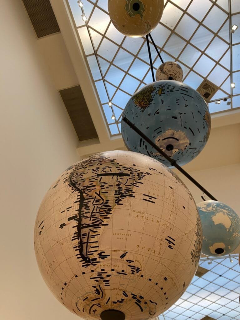
Reionder said “In 2023 the artist Emilio Isgrò donated (t)his work of art called ‘Planetarium’ to the National Gallery of Modern and Contemporary Art, in Rome (Italy). He definitely did something with black ink and place names – but I could not figure out what precisely. I hope you like it. “
Apparently this technique of redacting the names of places is erasure – apparently “The crucial point of Isgrò’s work is that the erasure is not a negative or destructive act. On the contrary, he sees it as a positive, transformative gesture.“

Jeremy spotted this in the Wildlife Photographer of the Year exhibition at the Natural History Museum in Kensington. Hands up if you knew that intactness was a word! Looks like the UK is no doing too well on this measure.
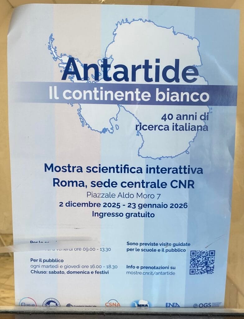
Reinder has been on a trip to Rome and sent loads of maps in the wild which we will feature over the next couple of weeks, interspersed with our Mappy Xmas specials. This one is from Sapienza University celebrating 40 years of Arctic research – we don’t get many maps of the White Continent.

We’re happy to announce that the next QGIS User Conference will take place in Switzerland in October 2026.
Please mark the following dates in your calendar:
As always, the conference will bring together users, developers, contributors, public administrations, companies, and educators from all over the world to share experiences, workflows, and ideas around QGIS and open-source GIS.
Location and further details will be published in January 2026.
For now, save the date and keep an eye out for the updates in January.
We’re looking forward to welcoming the global QGIS community to Switzerland.
Hola,
En arquitectura de sistemas hay una “ley no escrita” pero inmutable: nadie da nada gratis. Si optimizas agresivamente para una variable, estás pagando el precio en otra. Y en el mundo de la IA generativa, acabamos de toparnos con el ejemplo más brutal de este principio.
Llevamos todo el 2025 obsesionados con el tamaño de la ventana de contexto. 128k, 1 millón, 2 millones de tokens… Los proveedores nos vendían la idea de que podíamos volcar bibliotecas enteras en el prompt. Pero la realidad en producción nos dio un portazo en la cara: la latencia. Debido a la naturaleza cuadrática del mecanismo de atención, procesar esos contextos gigantescos hacía que el Time-To-First-Token (el tiempo que tardas en ver la primera palabra de la respuesta) se disparara a cifras inasumibles.
...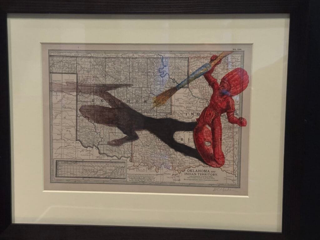
This contemporary piece is called “I forget where we were” by artist Jon Mackay, it’s a mixed media piece created on a vintage map of “Oklahoma and Indian Territory”. I can’t remember why it was in the Secret Maps exhibition!
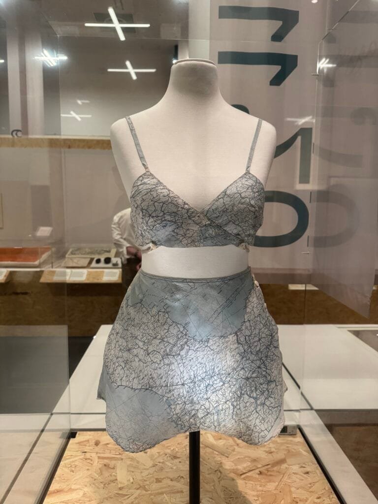
This bra and knickers set is made of Second World War escape maps – classified tools for evading enemy capture. It was made for Lady Mountbatten from RAF escape maps of Italy. Printed on silk for durability, these maps became surplus after the war when secrecy was no longer critical. Amid post-war silk shortages, these maps found surprising second lives. This example of wartime ingenuity reveals hidden histories in an unusually intimate form.
Rasterio 1.4.4 is on PyPI now. The first release in a year and ten days. If you're using Rasterio in 2025, shoot some thanks to Alan Snow, aka @snowman2 on Github. He's leading the effort to get Rasterio caught up to recent GDAL and Python changes, and it's not a cakewalk!
Release notes are here: https://github.com/rasterio/rasterio/releases/tag/1.4.4. That's a lot of bug fixes.

This is a really important map.
“The partition of British India in 1947 into the new nations of India and Pakistan resulted in massive displacement and loss of life. In 1946, this map was produced showing different potential boundary lines between the new countries, drawn by hand in black ink. The map accompanied this top-secret report commissioned by Earl Wavell, the Viceroy and Governor General of India, which investigated the potential impacts of partition on a newly created Pakistan”

2025 was another good year for gardening. We had only a tiny bit of hail damage in May and June, and a lengthy period of warm fall temperatures. I had the usual great green bean harvest, plentiful cucumbers and melons, and exceptional crops of peppers and tomatoes.
...Llevo meses trabajando con gemini-cli como un compañero de arquitectura. Un interlocutor técnico que lee, analiza, cuestiona y, sobre todo, espera. Hasta que, sin que yo modificara mi contexto, su patrón de interacción cambió radicalmente y comenzó a comportarse como un becario con tres cafés de más.
Sin ningún aviso o modificación por mi parte, la dinámica de trabajo se alteró por completo. Cada pregunta hipotética empezó a traducirse en un PR no solicitado. Cada “¿Qué te parece…?” activaba un refactor completo. El interlocutor analítico con el que había trabajado meses desapareció, sustituido por una lógica compulsiva de ejecución, que se anticipaba a mis instrucciones con acciones prematuras.
Este artículo documenta ese cambio. Describe el proceso para diagnosticar que el problema residía en el propio LLM y detalla el protocolo de contención que tuve que diseñar e implementar para recuperar el control de la interacción.
...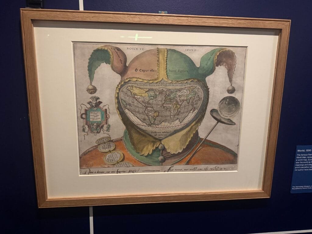
The Secret Maps exhibition at the British Library, London is well worth a visit. Over the next few days I am going to post some of the exhibits that were a bit Map in the Wild
First up is this 16th-century satirical engraving known as the Fool’s Cap Map of the World (circa 1590)
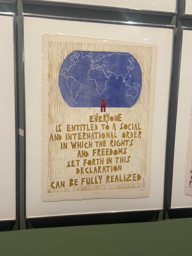
Saw this on a tour of The United Nations HQ in New York, it is part of a display of 30 wood block prints by Otavio Roth illustrating each of the articles of the Universal Declaration of Human Rights.
December 10 is Human Rights Day, a United Nations (UN) campaign that calls for people to know and push for their rights no matter where they are in the world.
Hola,
llevo un tiempo dándole vueltas a una pregunta: ¿cómo diseñamos agentes que no solo respondan a preguntas, sino que sean capaces de reaccionar a cambios en su entorno?
Piensa en un agente de DevOps que debe reaccionar a una caída de servidor, o en un sistema de análisis que necesita alertar sobre una anomalía en tiempo real. En todos estos casos, esperar a que el usuario pregunte ‘¿hay algún problema?’ llega demasiado tarde. La proactividad deja de ser una mejora para convertirse en un requisito funcional.
Los protocolos actuales no están diseñados para que el entorno hable primero. Este artículo explora ese vacío conceptual y propone un patrón de diseño para superarlo.
¿Qué es un agente? Del ejecutor de tareas al sistema proactivoEn un artículo anterior exploré la confusión que rodea al término ‘agente’. De aquel análisis surgió una distinción práctica basada en el comportamiento:
...You must be logged into the site to view this content.

Elizabeth spotted these mappy gift bags in a local shop
The GRASS GIS 8.4.2 release provides more than 35 improvements and fixes with respect to the release 8.4.1. Enjoy!
The post GRASS GIS 8.4.2 released appeared first on Markus Neteler Consulting.

Reinder said “My wife and I did a presentation / lecture on our new book ‘Nederland Waterland’ in the city of Roermond, in the south of the Netherlands, at a bookshop called De kleine tovenaar (the little wizzard). At the children’s books department, they’ve got a few globes … “

Reinder and his wife have written a book on Dutch history based on 100 maps (of course!) “The book deals with the history of our country in 100 maps and 100 essays – with the emphasis on water: floods, rivers, islands, tourism, harbours etc.”
I've got good news for people who love news about Rasterio, the Python package for reading and writing classic GIS raster data. Alan Snow is the release manager for 1.4.4 and 1.5.0 and has shepherded a release candidate with 40 wheels and one source distribution onto the Python Package Index: https://pypi.org/project/rasterio/1.4.4rc0/. The release notes are here.
Please try these out and let us know if they work as expected.

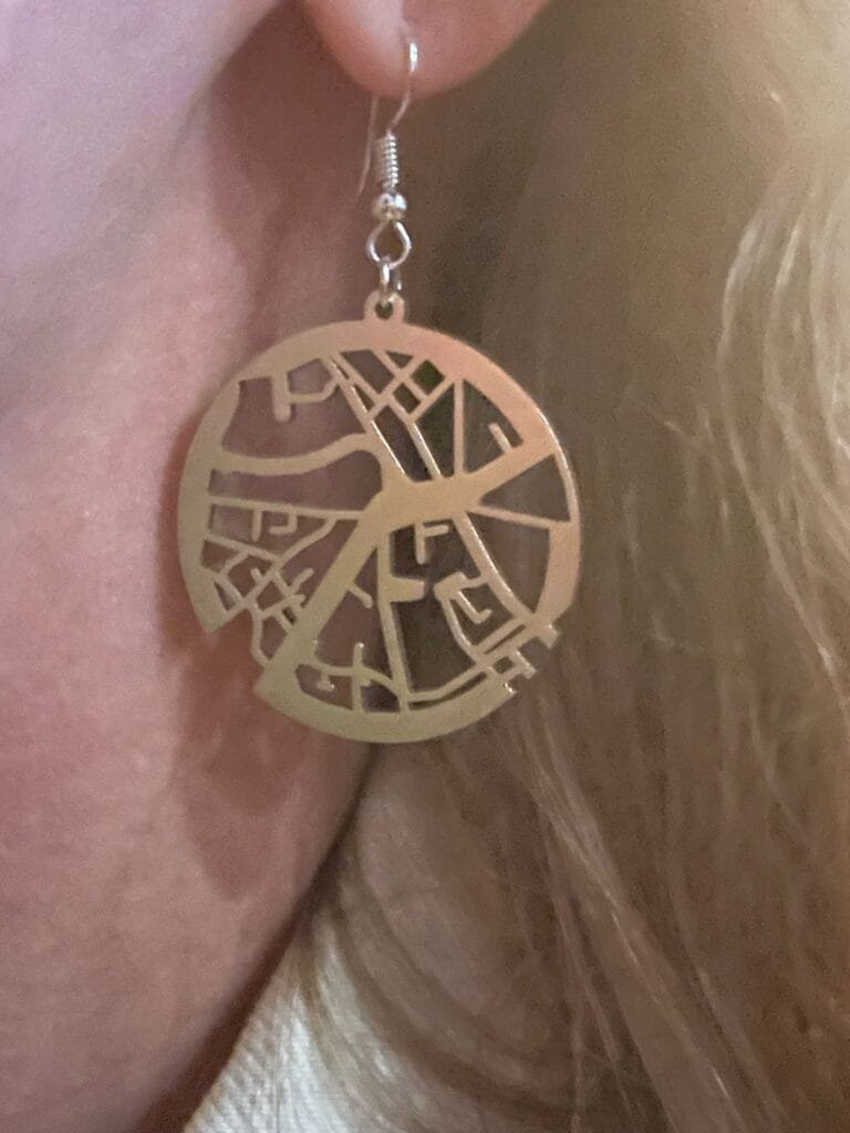
Toby spotted these map earrings at Geomob Lisbon a couple of weeks ago. They are designed by Kateryna Konieva who is launching her new collection of mappy jewellery
If I wore earrings …
The journey continues: QgsArrowIterator is now merged! This makes it possible to iterate over QgsFeatures as Arrow batches.
This is where we are now, quoting Dewey Dunnington:
...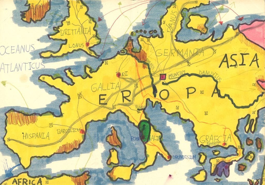
Reinder said “There is this quite prolific Dutch writer Ilja Leonard Pfeijffer, born in 1968. Today I heard a presentation on the work he did when he was a kid: he designed a country called Mocanië. The full design is extremely detailed, with even a language and a grammar. It was quite fascinating – and of course there were maps. It’s all in Dutch of course — but still. See https://literatuurmuseum.nl/verhalen/ilja-leonard-pfeijffer/het-ontstaan#wat-is-mocanie“
Propulsé par FreshRSS | 226 articles dans cette sélection
| Communauté | Ressources | L'emploi | Le marché | L'association | Fils RSS | |
|---|---|---|---|---|---|---|
|
Forum Blogs Wiki Planet Sites amis |
Agenda Biblio Fiches AMO-CNIG Paris PCGIS Téléchargements |
Offres d'emploi Banque de CV Formations Démarche Métiers |
Geo-Entreprises Geo-Communiqué Appels d'offres |
L'association Qui sommes-nous ? Nous aider Bienfaiteurs Partenaires Historique Statuts |
Tout le site Job Géomatique Services GeoBlogs ... |
 Faire un don Mentions légales

|