
Nous utilisons des cookies pour vous garantir la meilleure expérience sur notre site. Si vous continuez à utiliser ce dernier, nous considèrerons que vous acceptez l'utilisation des cookies. J'ai compris ! ou En savoir plus !.

Planet GeoRezo

Agrégateur de flux RSS - Actualités et contenus géomatiques


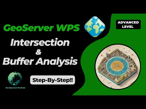
GeoServer Team: Master GeoServer WPS - Buffer & Intersection Analysis

GeoServer Team: Master GeoServer WPS - Buffer & Intersection Analysis

GeoSpatial Techno is a startup focused on geospatial information that is providing e-learning courses to enhance the knowledge of geospatial information users, students, and other startups. The main approach of this startup is providing quality, valid specialized training in the field of geospatial information.

( YouTube | LinkedIn | Facebook | X )

Master GeoServer WPS - Essential Buffer & Intersection Analysis Techniques!

This blog post provides how to use the Buffer and Intersection analysis in the WPS Request Builder. The WPS Request Builder is a demo page used to try out the Web Processing Service (WPS) used to execute geospatial processes for transformation, summary and analysis.

...
Lire la suite →

geomatico: ​Mapas de biodiversidad y estándares: del archivo al dato vivo ​ ​ ​

Jornadas SIG Libre 2025

Charla sobre casos de modernizaciĂłn de portales de biodiversidad con software libre para instituciones como el Instituto de Ciencias del Mar, la Universidad de Barcelona o el Museo de Ciencias Naturales de Barcelona.

Desde visores front-end ligeros hasta plataformas de ciencia ciudadana, explica cĂłmo transformar datos estĂĄticos en visores de mapas atractivos y recursos vivos para integrarse en redes globales como GBIF. Ponente: MartĂ­ Pericay

Lire l'article complet ↗
OSGeo Announcements: [OSGeo-Announce] TorchGeo 0.8.0 Release

OSGeo Announcements: [OSGeo-Announce] TorchGeo 0.8.0 Release

OSGeo TorchGeo 0.8.0 Release - OSGeo

You may have noticed that https://github.com/microsoft/torchgeo is now https://github.com/torchgeo/torchgeo. This is not an accident! TorchGeo now belongs to YOU, please join our monthly Technical Steering Committee meetings! TorchGeo...

Est. reading time: 2 minutes

Full release notes at Release v0.8.0 · torchgeo/torchgeo · GitHub

TorchGeo is a PyTorch domain library, similar to torchvision, providing
datasets, samplers, transforms, and pre-trained models specific to
geospatial data.

...
Lire la suite →

GRASS GIS: GRASS 8.4.2 released

What’s new in a nutshell The GRASS GIS 8.4.2 release provides more than 35 improvements and bug fixes compared to version 8.4.1. The changes span core GIS modules, GUI, Python support, packaging, and build infrastructure — making GRASS more stable, reliable, and polished for day-to-day use. Most importantly, since the 8.4.0 release: location is now project: The Python API, command line, and graphical user interface are using project instead of location for the main component of the data hierarchy while maintaining backward compatibility.
Lire l'article complet ↗
Oslandia: New in QGIS 3.40 : CMYK Support

Oslandia: New in QGIS 3.40 : CMYK Support

Credits : Bru-nO (Pixabay Content License)

Thanks to funding from the Bordeaux Metropolis, I had the chance to work on CMYK (Cyan Magenta Yellow blacK) support in QGIS. The metropolis’ goal is to remove the last barrier preventing their complete migration from ArcGIS to QGIS.

The developments are now complete and will be available in QGIS version 3.40, scheduled for release in October 2024, before becoming the next LTR in February 2025. It should be noted, however, that CMYK support will only be complete in QGIS versions built with Qt 6 (still unofficial version) for reasons explained in the article. On Windows, this version can currently only be installed using OSGeo4W (qgis-qt6-dev version).

...
Lire la suite →
TorchGeo: v0.8.0

TorchGeo: v0.8.0

TorchGeo 0.8.0 Release Notes

TorchGeo 0.8 includes 28 new pre-trained model weights and a number of improvements required for better time series support, including a complete rewrite of all GeoDataset and GeoSampler internals, encompassing 8 months of hard work by 23 contributors from around the world.

Highlights of this release Open and independent governance

You may have noticed that https://github.com/microsoft/torchgeo is now https://github.com/torchgeo/torchgeo. This is not an accident!

Note

TorchGeo now belongs to YOU, please join our monthly Technical Steering Committee meetings!

...
Lire la suite →
Mappery: Europa League Cup

Mappery: Europa League Cup

Ken drew my attention to the EUFA logo on the Europa League Cup. I think the purpose was that Arsenal haven’t won much in the last 20 years while this year’s cup was being held by the Spurs manager Ange Postecoglou who subsequently got sacked (twice within a few months!)

Lire l'article complet ↗
OSGeo Announcements: [OSGeo-Announce] OSGeo Charter Member election 2025 results

OSGeo Announcements: [OSGeo-Announce] OSGeo Charter Member election 2025 results

OSGeo OSGeo Charter Member election 2025 results - OSGeo

Carlos Eduardo Mota from Brasil LuĂ­s Calisto from Portugal Kateryna Konieva from Portugal Benjamin Webb from United States of America Joseph Emile Honour Percival from Samoa Weston Renoud from Netherlands Felix Delattre from Germany Julia Signell...

Est. reading time: 2 minutes

Dear all,

the CRO is pleased to announce the list of new OSGeo Carter Members:

...
Lire la suite →

Oslandia: [Customer Testimonial] Nicolas Godet, ISL Engineering

A hydraulic engineer by training, Nicolas Godet has been working at ISL Ingénierie for just over seven years and holds the position of hydraulic project manager (flood risk, hydraulic structure safety), deputy director of the Saint-Jean-de-Luz facility, and QGIS (and GIS in general) advisor.

He discusses the implementation of QDT and the associated methodology for deploying QGIS across ISL’s IT infrastructure.

What are the objectives of the collaboration?

Before I took charge of deploying QGIS at ISL, it was a bit of a mess: no one had the same version, the same plugins, or the same practices.
Following the switch to QGIS3, there was a desire to standardize the QGIS fleet at ISL to have the same version, the same plugin base, and preconfigured profiles.

An initial, semi-homemade solution was implemented in 2022, but it proved difficult to maintain.

...
Lire la suite →

Propulsé par FreshRSS | 226 articles dans cette sélection